Surveying Engineering Technology
Surveying Engineering Technology
Surveying Engineering Technology
The Surveying Engineering Technology program at Rowan University emphasizes fundamental surveying principles that prepare students for careers in the geospatial industries. The program is a continuation of the Associate Degree program in Surveying Engineering Technology at Rowan College of South Jersey (RCSJ). Students complete the first two years of the program at RCSJ, after which they earn an associate degree in Surveying Engineering Technology. They then have the option to continue at Rowan University for another two years to earn the bachelor’s degree.
The entire curriculum is designed to provide students with the practical and technical knowledge to make precise land-related measurements using traditional and modern surveying instruments to conduct boundary retracement, topographic mapping, and construction surveying. Instruction is provided in the subject areas of land surveying, mapping, photogrammetry, data analysis and adjustment, geodesy, map projections and coordinate systems, and geographic information systems (GIS).
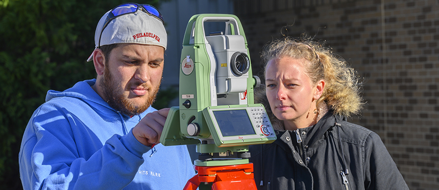
As a technology-oriented program, students learn modern data collection techniques using traditional and modern surveying instruments, softcopy photogrammetry methods, drones, terrestrial laser scanners, and the global navigation satellite systems (GNSS). They also study legal principles related to land surveying and property boundaries matters, professional ethics, Geographic Information Systems (GIS) applications in surveying, and data management techniques.
Beside working for any of the companies and agencies listed above, graduates can go through the examination process to become licensed professional surveyors.
What is Land Surveying?
Land Surveying is a discipline that encompasses all methods for capturing relative information on, above, or below the physical Earth and our environment, processing, and disseminating that information. Land surveying activities are mostly conducted outdoors. Most of the field surveyor's work is performed outdoors, whether it is staking out buildings, roads, bridges, or subdividing large tracts of land and retracing property boundaries. Computer Aided Drafting and Geographic Information Systems are technologies for making maps and analyzing spatial data.
This career may be for students interested in math, geography, working with computers, outdoor activities, problem-solving, and working with other professionals.
International Federation of Surveyors (FIG) has adopted the definition of a Land Surveyor as a professional with the academic qualifications and technical expertise to conduct one, or more, of the following activities:
![]() determine, measure, and represent land, three-dimensional objects, point-fields, and trajectories,
determine, measure, and represent land, three-dimensional objects, point-fields, and trajectories,
![]() assemble and interpret information about land and spatially related features,
assemble and interpret information about land and spatially related features,
![]() use information about land and related features for the planning and efficient administration of the land, the sea, and any structures thereon, and,
use information about land and related features for the planning and efficient administration of the land, the sea, and any structures thereon, and,
![]() conduct research into the above practices and to develop them.
conduct research into the above practices and to develop them.